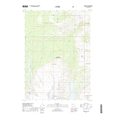
2017 Map of Simpson Lake
USGS Topo · Published 2017About this map
Shoshone National Forest encompasses this high-elevation landscape, where glacial activity has carved a complex network of alpine basins and granite peaks. The hydrography is defined by a significant cluster of high lakes, including Simpson Lake, Ross Lake, and Alice Lake, which feed the drainages of Jakeys Fork and Wasson Cr. The terrain is marked by prominent summits such as Whiskey Mtn and Shale Mtn, rising above timberline.
Find a feature on this map
45 named features on this map. Tap any name to fly to it.
Don’t see what you’re looking for? This feature index may not catch every label — zoom into the map to look around manually.
Map Details
Editions of this 2017 Simpson Lake Map
This is the sole edition of this map. No revisions or reprints were ever made.
Other maps of this area

1905 · Younts Peak
USGS Topo · 1:125,000

1907 · Younts Peak
USGS Topo · 1:125,000

1909 · Fremont Peak
USGS Topo · 1:125,000

1955 · Thermopolis
USGS Topo · 1:250,000

1956 · Dubois
USGS Topo · 1:24,000

1956 · Warm Spring Mountain
USGS Topo · 1:24,000

1956 · Mason Draw
USGS Topo · 1:24,000

1958 · Thermopolis
USGS Topo · 1:250,000

1962 · Thermopolis
USGS Topo · 1:250,000
1968 · Union Peak
USGS Topo · 1:24,000