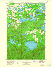
1953 Map of Siseebakwet Lake
USGS Topo · Published 1965About this map
Mississippi River waters wind through the northern portion of this Itasca County landscape, establishing a complex hydrological network of glacial lakes and marshy basins in the early 1950s. The area is dominated by the deep basin of Siseebakwet Lake and the sprawling Rice Lake, connected by Rice Creek. This map captures a period when seasonal recreation and conservation were defining local land use, evidenced by the presence of Otis Lodge near the shoreline and a Fish Hatchery to the east. Smaller settlements are sparse, though a Community Hall and a Landing Field indicate the social and transportation hubs for the residents of Bass Brook. Further north, Jay Gould Lake and Loon Lake extend the navigable water system, while numerous named ponds like Dead Horse Lake and Figure Eight Lake dot the wooded terrain.
Find a feature on this map
37 named features on this map. Tap any name to fly to it.
Don’t see what you’re looking for? This feature index may not catch every label — zoom into the map to look around manually.
Map Details
Editions of this 1953 Siseebakwet Lake Map
3 editions found
Other maps of this area

1953 · Cohasset East
USGS Topo · 1:24,000

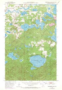
1953 · Siseebakwet Lake
USGS Topo · 1:24,000

1953 · Cohasset West
USGS Topo · 1:24,000

1953 · Grand Rapids
USGS Topo · 1:24,000

1954 · Hibbing
USGS Topo · 1:250,000

1957 · Hibbing
USGS Topo · 1:250,000

1958 · Hibbing
USGS Topo · 1:250,000

1964 · Hibbing
USGS Topo · 1:250,000

1970 · Big Thunder Peak
USGS Topo · 1:24,000
1970 · Mountain Ash Lake
USGS Topo · 1:24,000