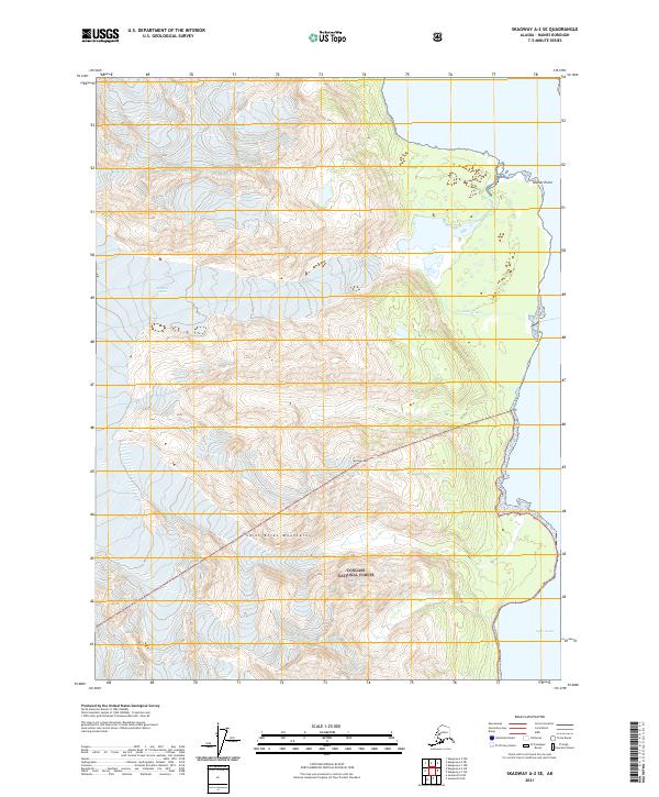
2021 Map of Skagway A-2 SE
USGS Topo · Published 2021About this map
The coastal frontier where the Saint Elias Mountains meet the sea is captured in this survey, dominated by the massive ice and silt deposits of the Glacier River. Flowing toward the deep waters of Lynn Canal, the river creates an evolving alluvial landscape near Glacier Point, a prominent coastal landmark that marks the transition from high-altitude peaks to the marine corridor. This area, largely contained within the Tongass National Forest, illustrates the immense scale of glacial drainage and its influence on the shoreline of Haines Borough. High-altitude markers like Sullivan Mtn overlook a terrain defined by steep contours and glacial carving, where human impact is minimal and the physical environment is shaped entirely by the forces of ice and water.
Find a feature on this map
11 named features on this map. Tap any name to fly to it.
Don’t see what you’re looking for? This feature index may not catch every label — zoom into the map to look around manually.
Map Details
Editions of this 2021 Skagway A-2 SE Map
This is the sole edition of this map. No revisions or reprints were ever made.
Other maps of this area

1948 · Skagway A-1
USGS Topo · 1:63,360

1949 · Juneau D-5
USGS Topo · 1:63,360

1951 · Juneau
USGS Topo · 1:250,000

1951 · Skagway A-1
USGS Topo · 1:63,360

1952 · Skagway
USGS Topo · 1:250,000

1954 · Skagway A-2
USGS Topo · 1:63,360

1961 · Skagway
USGS Topo · 1:250,000

1962 · Juneau
USGS Topo · 1:250,000
1991 · Skagway A-1 NW
USGS Topo · 1:25,000
1991 · Skagway A-2 NE
USGS Topo · 1:25,000