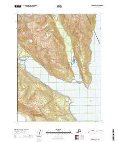
2017 Map of Skagway B-2 SE
USGS Topo · Published 2017About this map
The coastal settlement of Haines and the nearby village of Tanani anchor this 2017 survey of the Upper Lynn Canal region. The landscape is defined by deep glacial waterways, including Lutak Inlet and Chilkoot Inlet, which separate massive landforms like the Halutu Peninsula and Mt Ripinski. The transport network relies on the Haines Highway/Lutak Road, which skirts the steep shoreline between the peaks and the water's edge.
Find a feature on this map
31 named features on this map. Tap any name to fly to it.
Don’t see what you’re looking for? This feature index may not catch every label — zoom into the map to look around manually.
Map Details
Editions of this 2017 Skagway B-2 SE Map
This is the sole edition of this map. No revisions or reprints were ever made.
Other maps of this area

1948 · Skagway A-1
USGS Topo · 1:63,360

1949 · Skagway B-1
USGS Topo · 1:63,360

1951 · Skagway A-1
USGS Topo · 1:63,360

1951 · Skagway B-1
USGS Topo · 1:63,360

1952 · Skagway
USGS Topo · 1:250,000

1954 · Skagway B-2
USGS Topo · 1:63,360

1954 · Skagway A-2
USGS Topo · 1:63,360

1961 · Skagway
USGS Topo · 1:250,000
1991 · Skagway B-2 SW
USGS Topo · 1:25,000
1991 · Skagway A-1 NW
USGS Topo · 1:25,000