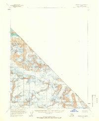
1961 Map of Skagway B-8
USGS Topo · Published 1966About this map
The Alsek River cuts through the extreme northwestern corner of this territory, marking a rare break in a landscape dominated by massive glacial ice fields. This 1961 survey, based on aerial photography from the late 1940s and 1950s, documents the international boundary between British Columbia, Alaska and the Canada-United States border. The map is defined by its dramatic topography, where numerous crevasses are charted across the high-elevation ice, indicating the active and shifting nature of the glaciers at mid-century. Because no roads or trails are present, the sheet serves as a pure record of the physical frontier as it was understood by the U.S. Geological Survey and the International Boundary Commission before modern satellite mapping.
Find a feature on this map
4 named features on this map. Tap any name to fly to it.
Don’t see what you’re looking for? This feature index may not catch every label — zoom into the map to look around manually.
Map Details
Editions of this 1961 Skagway B-8 Map
2 editions found
Other maps of this area

1951 · Yakutat
USGS Topo · 1:250,000

1952 · Skagway
USGS Topo · 1:250,000

1959 · Yakutat A-1
USGS Topo · 1:63,360

1959 · Yakutat B-1
USGS Topo · 1:63,360

1959 · Yakutat
USGS Topo · 1:250,000

1961 · Skagway A-7
USGS Topo · 1:63,360
1961 · Skagway B-8
USGS Topo · 1:63,360

1961 · Skagway A-8
USGS Topo · 1:63,360

1961 · Skagway
USGS Topo · 1:250,000
1985 · Yakutat C-1
USGS Topo · 1:63,360