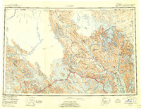
1952 Map of Skagway
USGS Topo · Published 1956About this map
The Chilkat River and Klehini River systems anchor this 1952 study of the coastal and alpine corridor connecting Southeast Alaska to the Canadian interior. Along these waterways, traditional and industrial settlements like Klukwan and Porcupine emerge at the base of the Takhanuk Mountains, illustrating the long-standing importance of this valley as a transit route. The infrastructure of the era is clearly defined by the White Pass and Yukon Route climbing the eastern peaks and the Haines Highway tracing the riverbanks toward Pleasant Camp on the international boundary. From the coastal enclave of Haines and Port Chilkoot to the remote outposts of Glacier Camp and Stonehouse, the map documents a landscape defined by its glaciers, such as those in Glacier Bay National Monument, and the difficult terrain that shaped the northern economy.
Find a feature on this map
153 named features on this map. Tap any name to fly to it.
Don’t see what you’re looking for? This feature index may not catch every label — zoom into the map to look around manually.
Map Details
Editions of this 1952 Skagway Map
4 editions found

Other maps of this area

1948 · Skagway C-4
USGS Topo · 1:63,360

1948 · Skagway C-3
USGS Topo · 1:63,360

1948 · Mount Fairweather D-1
USGS Topo · 1:63,360

1948 · Juneau D-3
USGS Topo · 1:63,360

1948 · Skagway C-2
USGS Topo · 1:63,360

1948 · Skagway A-1
USGS Topo · 1:63,360

1948 · Mount Fairweather D-2
USGS Topo · 1:63,360

1948 · Skagway C-1
USGS Topo · 1:63,360

1949 · Atlin
USGS Topo · 1:250,000

1949 · Juneau D-6
USGS Topo · 1:63,360