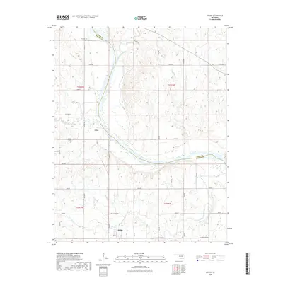
2018 Map of Skedee
USGS Topo · Published 2018About this map
Skedee sits at the southern end of this landscape, where the local road network including Blackburn-Skedee Rd and Grain Elevator Rd reflects the area's agricultural foundations. The Arkansas River winds centrally through the terrain, defining the boundary between Osage and Pawnee counties. This river corridor is fed by numerous tributaries such as Gray Horse Creek and Coal Creek, which create a complex drainage pattern across the township and range sections.
Find a feature on this map
47 named features on this map. Tap any name to fly to it.
Don’t see what you’re looking for? This feature index may not catch every label — zoom into the map to look around manually.
Map Details
Editions of this 2018 Skedee Map
This is the sole edition of this map. No revisions or reprints were ever made.
Other maps of this area

1929 · Skedee
USGS Topo · 1:62,500

1930 · Pawnee
USGS Topo · 1:62,500

1931 · Skedee
USGS Topo · 1:62,500

1932 · Fairfax
USGS Topo · 1:62,500

1936 · Belford
USGS Topo · 1:62,500

1936 · Pawnee
USGS Topo · 1:62,500

1955 · Enid
USGS Topo · 1:250,000

1958 · Enid
USGS Topo · 1:250,000
1978 · Pawnee
USGS Topo · 1:24,000
1978 · Lucy Creek
USGS Topo · 1:24,000