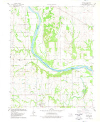
1978 Map of Skedee
USGS Topo · Published 1978About this map
The Arkansas River serves as the primary geographical divider in this portion of Pawnee and Osage counties, marking the Osage Indian Reservation Boundary. The landscape is a mix of river bottomlands and elevated terrain like Big Hill, with the southern reaches defined by the winding course of Black Bear Creek and Crystal Creek. This era of the late 1970s shows a region defined by its energy and transportation infrastructure, including an active Oil Field and the Atchison Topeka and Santa Fe railroad cutting through the river valley near Jobes.
Find a feature on this map
26 named features on this map. Tap any name to fly to it.
Don’t see what you’re looking for? This feature index may not catch every label — zoom into the map to look around manually.
Map Details
Editions of this 1978 Skedee Map
This is the sole edition of this map. No revisions or reprints were ever made.
Other maps of this area

1929 · Skedee
USGS Topo · 1:62,500

1930 · Pawnee
USGS Topo · 1:62,500

1931 · Skedee
USGS Topo · 1:62,500

1932 · Fairfax
USGS Topo · 1:62,500

1936 · Belford
USGS Topo · 1:62,500

1936 · Pawnee
USGS Topo · 1:62,500

1955 · Enid
USGS Topo · 1:250,000

1958 · Enid
USGS Topo · 1:250,000
1978 · Pawnee
USGS Topo · 1:24,000
1978 · Lucy Creek
USGS Topo · 1:24,000