
1965 Map of Slaton
USGS Topo · Published 1966About this map
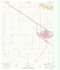
The town of Slaton anchors the eastern edge of the South Plains in this mid-1960s survey, showing a concentrated urban grid defined by a network of local streets including Lubbock Ave and Division St. The community is deeply influenced by the Atchison Topeka and Santa Fe railroad, which bisects the landscape and passes through the smaller settlement of Posey. This era shows a robust social infrastructure with several educational institutions like Evans High Sch and Stephen F Austin Sch, alongside Mercy Hospital.
Find a feature on this map
30 named features on this map. Tap any name to fly to it.
Don’t see what you’re looking for? This feature index may not catch every label — zoom into the map to look around manually.
Map Details
Editions of this 1965 Slaton Map
2 editions found
Other maps of this area

1954 · Lubbock
USGS Topo · 1:250,000

1957 · Lubbock East
USGS Topo · 1:24,000

1957 · New Home
USGS Topo · 1:62,500

1957 · Lubbock
USGS Topo · 1:62,500

1965 · Acuff
USGS Topo · 1:24,000

1965 · Buffalo Springs Lake
USGS Topo · 1:24,000

1965 · Southland
USGS Topo · 1:24,000

1965 · Wilson
USGS Topo · 1:24,000

1965 · Slaton NE
USGS Topo · 1:24,000

1976 · New Home NE
USGS Topo · 1:24,000