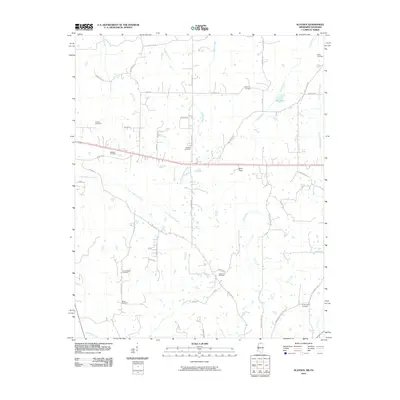
2010 Map of Slayden
USGS Topo · Published 2010About this map
Stout Creek and Golden Creek weave through this landscape in Marshall County, which is defined by a dense network of local family-named cemeteries and rural roads. The concentration of burial sites like Isom Chapel Cemetery, Gatewood Cemetery, and Kimbrough Cemetery provides a clear view of the area's ancestral settlement patterns and the importance of church-centered communities. To the north, the Mill Pond and the Sand Flats suggest variations in the terrain and local water use near the Tennessee border. The map documents the rural infrastructure of the early 2000s, where named paths like Roberts Chapel Rd and Hurdle Club Rd connect dispersed homesteads across the drainage basins of the Little Coldwater Creek and Coldwater River.
Find a feature on this map
46 named features on this map. Tap any name to fly to it.
Don’t see what you’re looking for? This feature index may not catch every label — zoom into the map to look around manually.
Map Details
Editions of this 2010 Slayden Map
This is the sole edition of this map. No revisions or reprints were ever made.
Other maps of this area

1943 · Collierville
USGS Topo · 1:62,500

1948 · Byhalia
USGS Topo · 1:62,500

1949 · Moscow
USGS Topo · 1:62,500

1953 · Holly Springs
USGS Topo · 1:62,500

1953 · Collierville
USGS Topo · 1:50,000

1956 · Blytheville
USGS Topo · 1:250,000

1956 · Tupelo
USGS Topo · 1:250,000

1958 · Tupelo
USGS Topo · 1:250,000

1959 · Blytheville
USGS Topo · 1:250,000

1964 · Holly Springs SE
USGS Topo · 1:24,000