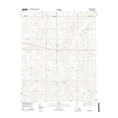
2015 Map of Slayden
USGS Topo · Published 2015About this map
Slayden and Early Grove serve as the primary anchors for this northern Mississippi landscape, situated just south of the border between Marshall County and Fayette County. The area is defined by a dense concentration of family and community burial grounds, such as Isom Chapel Cem, Bethel Cem, and Kimbrough Cem, which provide significant points of interest for genealogical research. The terrain is crisscrossed by numerous waterways, including Little Coldwater Creek and Clear Creek, leading down toward the Coldwater River in the southwest. A distinct transition in land use is visible near the Sand Flats, while the presence of Jeter Field and the Mill Pond northeast of Slayden suggests a history of local agriculture and resource management. The map's road network, featuring routes like Slayden Road and Concord Road, connects these small rural hubs and their scattered landmarks.
Find a feature on this map
80 named features on this map. Tap any name to fly to it.
Don’t see what you’re looking for? This feature index may not catch every label — zoom into the map to look around manually.
Map Details
Editions of this 2015 Slayden Map
This is the sole edition of this map. No revisions or reprints were ever made.
Other maps of this area

1943 · Collierville
USGS Topo · 1:62,500

1948 · Byhalia
USGS Topo · 1:62,500

1949 · Moscow
USGS Topo · 1:62,500

1953 · Holly Springs
USGS Topo · 1:62,500

1953 · Collierville
USGS Topo · 1:50,000

1956 · Blytheville
USGS Topo · 1:250,000

1956 · Tupelo
USGS Topo · 1:250,000

1958 · Tupelo
USGS Topo · 1:250,000

1959 · Blytheville
USGS Topo · 1:250,000

1964 · Holly Springs SE
USGS Topo · 1:24,000