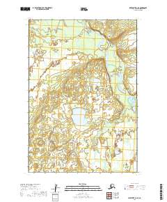
2019 Map of Sleetmute D-1 SE
USGS Topo · Published 2019About this map
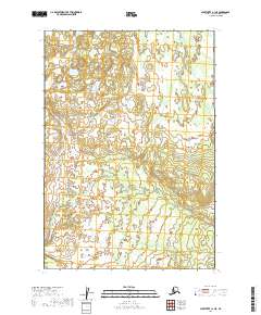
The Swift River cuts across the northern reaches of this Alaskan interior landscape, winding through a complex system of marshes and low-lying wetlands. Recorded in 2019, the map reveals a terrain where water and land are in constant flux, dominated by the intricate drainage patterns that feed into the river system. The vast wetland network suggests a seasonally dynamic environment, where the lack of established roads or permanent settlements emphasizes the dominance of natural hydrology over human infrastructure. This survey provides a baseline of the regional topography, showing how the river channel navigates through the township boundaries of t21n r38w and t21n r37w. For those studying the hydrography of the Bethel Census Area, the map offers a detailed view of the unnamed ponds and saturated flats that characterize this portion of the Sleetmute quadrangle.
Find a feature on this map
7 named features on this map. Tap any name to fly to it.
Don’t see what you’re looking for? This feature index may not catch every label — zoom into the map to look around manually.
Map Details
Editions of this 2019 Sleetmute D-1 SE Map
This is the sole edition of this map. No revisions or reprints were ever made.
Other maps of this area

1950 · Sleetmute
USGS Topo · 1:250,000

1951 · Lime Hills
USGS Topo · 1:250,000

1954 · Sleetmute D-1
USGS Topo · 1:63,360

1954 · Sleetmute C-1
USGS Topo · 1:63,360
1954 · Lime Hills D-8
USGS Topo · 1:63,360

1954 · Sleetmute
USGS Topo · 1:250,000
1958 · Lime Hills C-8
USGS Topo · 1:63,360

1958 · Lime Hills
USGS Topo · 1:250,000
2019 · Sleetmute D-1 SW
USGS Topo · 1:25,000
2019 · Sleetmute C-1 NE
USGS Topo · 1:25,000