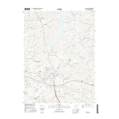
2016 Map of Slickville
USGS Topo · Published 2016About this map
Beaver Run Reservoir dominates the northern landscape of this Westmoreland County study, where rural crossroads like Mamont and Poke Run maintain their historic character. The map illustrates a transition between the established borough of Delmont and more modern developments spreading from Murrysville and White Valley. This era shows a complex network of local transit and infrastructure, centered around the Greensburg Jeannette Regional Airport in the southwest corner and the expanding residential corridors of Ringertown and Dunningtown. Researchers will find significant genealogical interest in the numerous burial grounds, including the Twin Valley Memorial Park Cem and the East View Cem near the intersection of several major state routes. The topography is defined by distinct hollows such as Boggs Hollow and Kemerer Hollow, which have historically dictated the placement of roads and early settlements like Trees Mills.
Find a feature on this map
178 named features on this map. Tap any name to fly to it.
Don’t see what you’re looking for? This feature index may not catch every label — zoom into the map to look around manually.
Map Details
Editions of this 2016 Slickville Map
This is the sole edition of this map. No revisions or reprints were ever made.
Other maps of this area

1900 · Latrobe
USGS Topo · 1:62,500

1902 · Latrobe
USGS Topo · 1:62,500

1902 · Elders Ridge
USGS Topo · 1:62,500

1903 · Latrobe
USGS Topo · 1:62,500

1904 · Elders Ridge
USGS Topo · 1:62,500

1904 · Greensburg
USGS Topo · 1:62,500

1906 · Greensburg
USGS Topo · 1:62,500

1907 · Freeport
USGS Topo · 1:62,500

1909 · Freeport
USGS Topo · 1:62,500

1953 · Pittsburgh
USGS Topo · 1:250,000