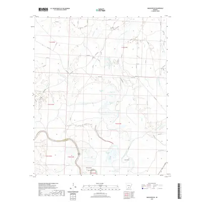
2020 Map of Smackover NE
USGS Topo · Published 2020About this map
The Ouachita River defines the southern portion of this landscape at the Calhoun Co Ouachita Co line, where the river's winding course creates distinct geographic markers like Haynes Bend. The surrounding lowlands are characterized by a complex network of water bodies, including Tom Cook Brake, Viney Brake, and Hades Lake, reflecting the wet timberlands typical of south-central Arkansas. For local history researchers, several burial sites are mapped across the northern half, such as Primm Cem, Moses Chapel Cem, and Saint Paul Cem, often located near rural corridors like Little Bay Rd. The transition from river bottom to slightly higher ground is marked by features like Boones Mound and navigation points such as Slim Island Shoal, which highlight how the river served as a vital, if shifting, landmark for travel and settlement.
Find a feature on this map
72 named features on this map. Tap any name to fly to it.
Don’t see what you’re looking for? This feature index may not catch every label — zoom into the map to look around manually.
Map Details
Editions of this 2020 Smackover NE Map
This is the sole edition of this map. No revisions or reprints were ever made.
Other maps of this area

1903 · Camden
USGS Topo · 1:125,000

1934 · Moro Bay
USGS Topo · 1:62,500

1938 · Moro Bay
USGS Topo · 1:62,500

1939 · Moro Bay
USGS Topo · 1:62,500

1953 · El Dorado
USGS Topo · 1:250,000

1957 · El Dorado
USGS Topo · 1:250,000

1958 · El Dorado
USGS Topo · 1:250,000

1960 · El Dorado
USGS Topo · 1:250,000

1962 · Smackover NE
USGS Topo · 1:24,000

1962 · Smackover
USGS Topo · 1:24,000