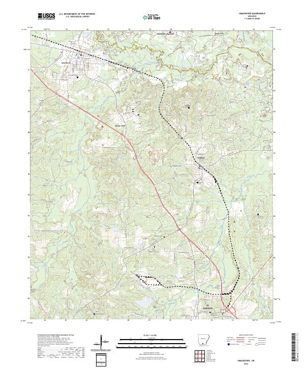
2024 Map of Smackover
USGS Topo · Published 2024About this map
Smackover and the surrounding Arkansas oil fields are charted in this detailed modern survey. The map centers on the winding course of Smackover Creek, which forms the boundary between Ouachita Co and Union Co. The landscape is a network of access roads and industrial sites, reflecting the long history of resource extraction in the region. Smaller settlements like Norphlet, Kenova, and Sandy Land are shown alongside numerous family and community landmarks. Researchers will find several burial sites preserved amidst the industrial activity, including Primm Cem, Hicks Cem, and the misspelled Samckover Cem. To the south, the map reaches the northern outskirts of El Dorado, showing the transition from the creek bottomlands to the expanding urban periphery near Rest Haven Memorial Gardens.
Find a feature on this map
79 named features on this map. Tap any name to fly to it.
Don’t see what you’re looking for? This feature index may not catch every label — zoom into the map to look around manually.
Map Details
Editions of this 2024 Smackover Map
This is the sole edition of this map. No revisions or reprints were ever made.
Other maps of this area

1927 · El Dorado
USGS Topo · 1:62,500

1930 · El Dorado
USGS Topo · 1:62,500

1951 · El Dorado
USGS Topo · 1:62,500

1953 · El Dorado
USGS Topo · 1:250,000

1957 · El Dorado
USGS Topo · 1:250,000

1958 · El Dorado
USGS Topo · 1:250,000

1960 · El Dorado
USGS Topo · 1:250,000

1962 · Lisbon
USGS Topo · 1:24,000

1962 · Louann
USGS Topo · 1:24,000

1962 · Smackover NE
USGS Topo · 1:24,000