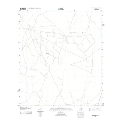
2012 Map of Smith Hills
USGS Topo · Published 2012About this map
Marfa Municipal Airport anchors the southeastern corner of this Trans-Pecos landscape, serving as a gateway to the high desert plains of Presidio County. The terrain is defined by the gradual ascent toward the Smith Hills, a prominent landform that rises above the surrounding flats. This arid environment is drained by two primary seasonal watercourses: the N Fork Alamito Cr and the S Fork Alamito Cr. The network of roads crisscrossing the plains reveals a pattern of ranching access and regional connectivity typical of the Chihuahuan Desert during the early twenty-first century. These ephemeral creek branches and gravel tracks offer a clear look at the hydraulic and transportation geography that supports life and aviation in this part of Far West Texas.
Find a feature on this map
4 named features on this map. Tap any name to fly to it.
Don’t see what you’re looking for? This feature index may not catch every label — zoom into the map to look around manually.
Map Details
Editions of this 2012 Smith Hills Map
This is the sole edition of this map. No revisions or reprints were ever made.
Other maps of this area

1894 · Valentine
USGS Topo · 1:125,000

1894 · Fort Davis
USGS Topo · 1:125,000

1895 · Marfa
USGS Topo · 1:125,000

1895 · Alpine
USGS Topo · 1:125,000

1897 · Valentine
USGS Topo · 1:125,000

1897 · Fort Davis
USGS Topo · 1:125,000

1943 · Valentine
USGS Topo · 1:125,000

1954 · Fort Stockton
USGS Topo · 1:250,000

1958 · Fort Stockton
USGS Topo · 1:250,000

1959 · Marfa
USGS Topo · 1:250,000