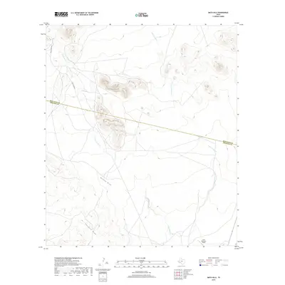
2019 Map of Smith Hills
USGS Topo · Published 2019About this map
Marfa Municipal Airport sits on the southern edge of this high-desert landscape in Presidio County, marking a point of modern infrastructure amidst a network of natural drainage basins. The terrain is defined by the convergence of prominent topographical features including Duncan Draw and Fourmile Draw, which guide the seasonal flow of water through the region. The drainage system is further articulated by the N Fork Alamito Cr and S Fork Alamito Cr, illustrating the hydrological patterns of the Trans-Pecos. The boundary between Jeff Davis and Presidio counties cuts across the northern section of the map, while local transportation is limited to established ranching routes like Hughes Ranch Rd and Smith-Coffey Rd, reflecting the sparse settlement and large-scale land use characteristic of this part of West Texas.
Find a feature on this map
8 named features on this map. Tap any name to fly to it.
Don’t see what you’re looking for? This feature index may not catch every label — zoom into the map to look around manually.
Map Details
Editions of this 2019 Smith Hills Map
This is the sole edition of this map. No revisions or reprints were ever made.
Other maps of this area

1894 · Valentine
USGS Topo · 1:125,000

1894 · Fort Davis
USGS Topo · 1:125,000

1895 · Marfa
USGS Topo · 1:125,000

1895 · Alpine
USGS Topo · 1:125,000

1897 · Valentine
USGS Topo · 1:125,000

1897 · Fort Davis
USGS Topo · 1:125,000

1943 · Valentine
USGS Topo · 1:125,000

1954 · Fort Stockton
USGS Topo · 1:250,000

1958 · Fort Stockton
USGS Topo · 1:250,000

1959 · Marfa
USGS Topo · 1:250,000