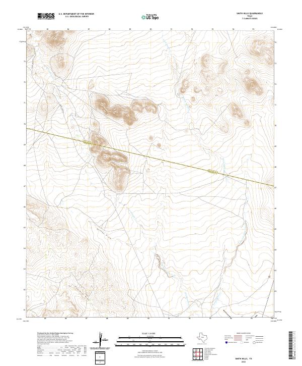
2022 Map of Smith Hills
USGS Topo · Published 2022About this map
North Fork Alamito Creek and South Fork Alamito Creek converge in this high-desert landscape, defining the drainage patterns south of the county line. The terrain is deeply inscribed by seasonal watercourses such as Duncan Draw and Fourmile Draw, which cut through the arid ranchlands. The administrative boundary between Jeff Davis Co and Presidio Co bisects the area, highlighting the remote nature of this borderland. Human presence is sparse, indicated primarily by two local thoroughfares: Hughes Ranch Rd and Smith-Coffey Rd, which provide access to isolated holdings. The map illustrates how topography and water availability dictate the layout of these rural Texas ranching territories, where every named creek and draw serves as a vital navigational landmark.
Find a feature on this map
9 named features on this map. Tap any name to fly to it.
Don’t see what you’re looking for? This feature index may not catch every label — zoom into the map to look around manually.
Map Details
Editions of this 2022 Smith Hills Map
This is the sole edition of this map. No revisions or reprints were ever made.
Other maps of this area

1894 · Valentine
USGS Topo · 1:125,000

1894 · Fort Davis
USGS Topo · 1:125,000

1895 · Marfa
USGS Topo · 1:125,000

1895 · Alpine
USGS Topo · 1:125,000

1897 · Valentine
USGS Topo · 1:125,000

1897 · Fort Davis
USGS Topo · 1:125,000

1943 · Valentine
USGS Topo · 1:125,000

1954 · Fort Stockton
USGS Topo · 1:250,000

1958 · Fort Stockton
USGS Topo · 1:250,000

1959 · Marfa
USGS Topo · 1:250,000