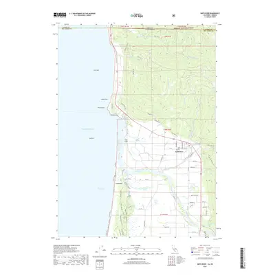
2018 Map of Smith River
USGS Topo · Published 2018About this map
The Smith River estuary and the surrounding Del Norte County coastline define this landscape where the Pacific Ocean meets the northernmost reaches of California. The settlement of Smith River serves as a central hub, with its streets organized around 1st St and W First St, while the Smith River Cem provides a point of genealogical interest nearby. To the north, the terrain transitions into the Siskiyou National Forest along the border of Curry County, Oregon. The coastal margin is marked by significant topographical features such as Pyramid Point, Prince Island, and Hunter Rock, illustrating the coastal geology of Pelican Bay. Further south, the map details the marshy reaches of Tillas Slough and Yontocket Slough, which separate the mainland from Tillas Island and the coastal community of Yontocket.
Find a feature on this map
67 named features on this map. Tap any name to fly to it.
Don’t see what you’re looking for? This feature index may not catch every label — zoom into the map to look around manually.
Map Details
Editions of this 2018 Smith River Map
This is the sole edition of this map. No revisions or reprints were ever made.
Other maps of this area

1929 · Crescent City
USGS Topo · 1:125,000

1945 · Point St. George
USGS Topo · 1:62,500

1949 · Eureka
USGS Topo · 1:250,000

1952 · Crescent City
USGS Topo · 1:62,500

1954 · Coos Bay
USGS Topo · 1:250,000

1954 · Cape Ferrelo
USGS Topo · 1:62,500

1954 · Mt. Emily
USGS Topo · 1:62,500

1956 · Crescent City
USGS Topo · 1:24,000

1956 · Smith River
USGS Topo · 1:24,000

1958 · Eureka
USGS Topo · 1:250,000