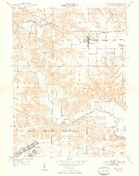
1948 Map of Smithfield
USGS Topo · Published 1948About this map
The Camp Ellis Military Reservation dominates the southern landscape of this Fulton County quadrangle, showing the footprint of the World War II-era training camp just as it appeared in the late 1940s. Complete with its grid of barracks and the Camp Ellis Landing Strip, the reservation occupies former farmland north of the Spoon River. To the north, the Toledo Peoria and Western railroad corridor links the rural settlements of Seville and Smithfield, serving as a vital artery for the region's agricultural economy. The map is particularly rich for genealogical research, documenting numerous one-room schoolhouses like the Little Brick School and Howerter Sch, along with family-named burial sites such as Fuller Cem and Baughman Cem. These landmarks, along with crossings like Bernadotte Bridge, illustrate a tightly knit community structure defined by small townships and local rural institutions during the mid-century period.
Find a feature on this map
31 named features on this map. Tap any name to fly to it.
Don’t see what you’re looking for? This feature index may not catch every label — zoom into the map to look around manually.
Map Details
Editions of this 1948 Smithfield Map
2 editions found
Other maps of this area

1912 · Canton
USGS Topo · 1:62,500

1915 · Avon
USGS Topo · 1:62,500

1918 · Vermont
USGS Topo · 1:62,500

1921 · Vermont
USGS Topo · 1:62,500

1925 · Havana
USGS Topo · 1:62,500

1944 · Avon
USGS Topo · 1:62,500

1947 · Lewistown
USGS Topo · 1:24,000

1947 · Vermont
USGS Topo · 1:24,000

1947 · Adair
USGS Topo · 1:24,000

1948 · Duncan Mills
USGS Topo · 1:24,000