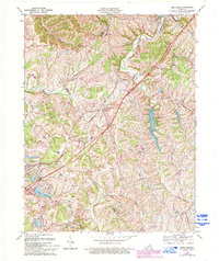
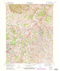
1969 Map of Smithfield
USGS Topo · Published 1994About this map
Louisville and Nashville rail lines dominate the landscape of Henry and Oldham Counties, anchoring a series of small rural communities. The map depicts a transitional period where established settlements like Smithfield and Sulphur sit alongside newer infrastructure development. The creation of Lake Jericho and its adjacent Recreation Area and Boat Ramp indicates the mid-century shift toward water-based public leisure, while the prominent Interchange 28 signals the rising influence of the interstate highway system on this traditionally agrarian corridor. Local institutions such as the Ballard School and numerous Cem sites reflect the long-standing community footprint of the Little Kentucky River and Floyds Fork valleys. Smaller, now-obscure locales including Liro, Tarascon, and Jericho are captured in detail, providing a valuable record of the northern Bluegrass region's settlement pattern before late 20th-century modernization further altered the rural character.
Find a feature on this map
32 named features on this map. Tap any name to fly to it.
Don’t see what you’re looking for? This feature index may not catch every label — zoom into the map to look around manually.
Map Details
Editions of this 1969 Smithfield Map
5 editions found
Other maps of this area

1928 · New Castle
USGS Topo · 1:48,000

1932 · New Castle
USGS Topo · 1:62,500

1932 · La Grange
USGS Topo · 1:62,500

1939 · Bethlehem
USGS Topo · 1:24,000

1948 · Bethlehem
USGS Topo · 1:24,000

1951 · Crestwood
USGS Topo · 1:24,000

1952 · Campbellsburg
USGS Topo · 1:24,000

1953 · Bedford
USGS Topo · 1:24,000

1953 · Bethlehem
USGS Topo · 1:24,000

1954 · Ballardsville
USGS Topo · 1:24,000