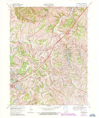
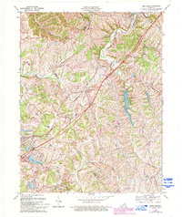
1969 Map of Smithfield
USGS Topo · Published 1987About this map
The confluence of agricultural land and growing transportation corridors marks this region of the Kentucky Bluegrass at the end of the 1960s. Sulphur and Smithfield serve as established rural hubs, anchored by community landmarks such as Sulphur Sch and Smithfield Ch. The landscape is etched by numerous waterways, including the Little Kentucky River and the winding Harrods Creek, which define the rolling boundaries between Henry, Oldham, and Trimble counties.
Find a feature on this map
38 named features on this map. Tap any name to fly to it.
Don’t see what you’re looking for? This feature index may not catch every label — zoom into the map to look around manually.
Map Details
Editions of this 1969 Smithfield Map
5 editions found
Other maps of this area

1928 · New Castle
USGS Topo · 1:48,000

1932 · New Castle
USGS Topo · 1:62,500

1932 · La Grange
USGS Topo · 1:62,500

1939 · Bethlehem
USGS Topo · 1:24,000

1948 · Bethlehem
USGS Topo · 1:24,000

1951 · Crestwood
USGS Topo · 1:24,000

1952 · Campbellsburg
USGS Topo · 1:24,000

1953 · Bedford
USGS Topo · 1:24,000

1953 · Bethlehem
USGS Topo · 1:24,000

1954 · Ballardsville
USGS Topo · 1:24,000