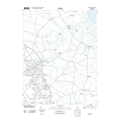
2011 Map of Smyrna
USGS Topo · Published 2011About this map
Smyrna anchors this landscape where the coastal plain of Delaware transitions into a complex network of marshes and necks. The town's historic footprint is marked by the Smyrna Post Office and the storied grounds of Belmont Hall, while modern residential growth is evident in developments like Mallards Run, Sunnyside Village, and Ridgewood Manor. The surrounding territory is defined by the winding course of the Smyrna River and its numerous landings, including Eagles Nest Landing and Shorts Landing, which point to a long history of water-based commerce and navigation along the Smyrna River and Duck Creek.
Find a feature on this map
83 named features on this map. Tap any name to fly to it.
Don’t see what you’re looking for? This feature index may not catch every label — zoom into the map to look around manually.
Map Details
Editions of this 2011 Smyrna Map
This is the sole edition of this map. No revisions or reprints were ever made.
Other maps of this area

1890 · Bay Side
USGS Topo · 1:62,500

1894 · Bay Side
USGS Topo · 1:62,500

1899 · Vineland
USGS Topo · 1:125,000

1899 · Dover
USGS Topo · 1:125,000

1906 · Dover
USGS Topo · 1:125,000

1919 · Vineland
USGS Topo · 1:125,000

1920 · Dover
USGS Topo · 1:125,000

1926 · Wyoming
USGS Topo · 1:48,000

1930 · Wyoming
USGS Topo · 1:62,500

1931 · Wyoming
USGS Topo · 1:62,500