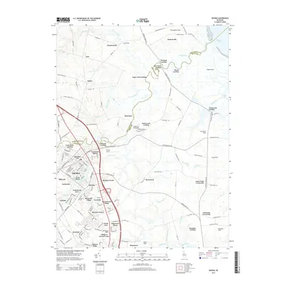
2014 Map of Smyrna
USGS Topo · Published 2014About this map
Smyrna serves as the hub of this region on the Delmarva Peninsula, where the landscape is defined by the winding course of the Smyrna River and its intricate drainage network. The town's historic core, including Commerce Square and neighborhoods like Spruance City, is flanked by numerous residential developments such as Burtonwood Village and Ridgewood Manor. The map captures a sophisticated network of landings along the waterways, including Smyrna Landing, Duck Creek Landing, and Long Point Landing, reflecting the area's deep ties to maritime commerce and river access. To the north, the transition from developed areas to the agricultural and marshy reaches of Thoroughfare Neck and Tadpole Neck is evident. Infrastructure like the Smyrna Airport and the expanding Village of Garrison Lake highlight the modern growth of this historic Kent County and New Castle County borderland.
Find a feature on this map
152 named features on this map. Tap any name to fly to it.
Don’t see what you’re looking for? This feature index may not catch every label — zoom into the map to look around manually.
Map Details
Editions of this 2014 Smyrna Map
This is the sole edition of this map. No revisions or reprints were ever made.
Other maps of this area

1890 · Bay Side
USGS Topo · 1:62,500

1894 · Bay Side
USGS Topo · 1:62,500

1899 · Vineland
USGS Topo · 1:125,000

1899 · Dover
USGS Topo · 1:125,000

1906 · Dover
USGS Topo · 1:125,000

1919 · Vineland
USGS Topo · 1:125,000

1920 · Dover
USGS Topo · 1:125,000

1926 · Wyoming
USGS Topo · 1:48,000

1930 · Wyoming
USGS Topo · 1:62,500

1931 · Wyoming
USGS Topo · 1:62,500