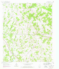
1961 Map of Smyrna
USGS Topo · Published 1978About this map
The rolling landscape of the Montague and Wise county line is defined by a dense network of family-named landmarks and rural congregations. Small rural centers like Smyrna and Pitman serve as anchors for a community dotted with country burial grounds, including the Fryer Cem, Huddleston Cem, and Pella Cem. The presence of the Union Hill Ch and the Cross Timbers Baptist Girlaland Camp Headquarters speaks to the region's long-standing spiritual and social focal points.
Find a feature on this map
27 named features on this map. Tap any name to fly to it.
Don’t see what you’re looking for? This feature index may not catch every label — zoom into the map to look around manually.
Map Details
Editions of this 1961 Smyrna Map
2 editions found
Other maps of this area

1905 · Montague
USGS Topo · 1:125,000

1954 · Sherman
USGS Topo · 1:250,000

1958 · Sherman
USGS Topo · 1:250,000

1961 · Pecan Creek
USGS Topo · 1:24,000

1961 · Salona
USGS Topo · 1:24,000

1961 · Alvord
USGS Topo · 1:24,000

1961 · New Harp
USGS Topo · 1:24,000

1961 · Sunset
USGS Topo · 1:24,000
1961 · Smyrna
USGS Topo · 1:24,000

1961 · Bowie
USGS Topo · 1:24,000