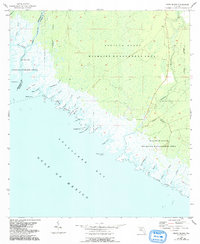
1955 Map of Snipe Island
USGS Topo · Published 1993About this map
Apalachee Bay defines the southwestern edge of this coastal landscape, where the tides of the Gulf of Mexico meet an intricate network of tidal creeks and marshes. The map documents a transition from the dense conservation lands of the St Marks National Wildlife Refuge and the Aucilla State Wildlife Management Area toward the southeastern corner of the county. In this sparsely populated region, human presence is concentrated at Econfina Landing on the banks of the Econfina River, which marks a primary navigation point for local maritime activity.
Find a feature on this map
31 named features on this map. Tap any name to fly to it.
Don’t see what you’re looking for? This feature index may not catch every label — zoom into the map to look around manually.
Map Details
Editions of this 1955 Snipe Island Map
5 editions found
Other maps of this area

1949 · Apalachicola
USGS Topo · 1:250,000

1954 · Johnson Hammock
USGS Topo · 1:24,000

1954 · St. Marks NE
USGS Topo · 1:24,000

1954 · Cobb Rocks
USGS Topo · 1:24,000

1954 · Gainesville
USGS Topo · 1:250,000

1954 · Valdosta
USGS Topo · 1:250,000

1954 · Tallahassee
USGS Topo · 1:250,000

1955 · Snipe Island
USGS Topo · 1:24,000

1955 · Nutall Rise
USGS Topo · 1:24,000

1955 · Rock Islands
USGS Topo · 1:24,000