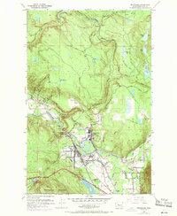
1953 Map of Snoqualmie
USGS Topo · Published 1970About this map
Industrial activity along the Snoqualmie River characterizes this mid-century look at King County, where the massive Lumber Mill and Snoqualmie Falls Powerhouse anchor the local economy. The landscape is defined by the dramatic drop at Snoqualmie Falls and the convergence of three river forks near Snoqualmie. This era shows a community deeply integrated with its geography, from the Fish Hatchery on Tokul Creek to the Mt Si Golf Course in the river valley.
Find a feature on this map
49 named features on this map. Tap any name to fly to it.
Don’t see what you’re looking for? This feature index may not catch every label — zoom into the map to look around manually.
Map Details
Editions of this 1953 Snoqualmie Map
5 editions found
Other maps of this area

1913 · Cedar Lake
USGS Topo · 1:125,000

1921 · Sultan
USGS Topo · 1:125,000

1923 · Sultan
USGS Topo · 1:125,000

1953 · Snoqualmie
USGS Topo · 1:24,000

1953 · North Bend
USGS Topo · 1:24,000

1953 · Lake Joy
USGS Topo · 1:24,000

1953 · Hobart
USGS Topo · 1:24,000

1953 · Fall City
USGS Topo · 1:24,000

1953 · Carnation
USGS Topo · 1:24,000

1957 · Wenatchee
USGS Topo · 1:250,000