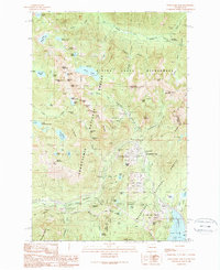
1989 Map of Snoqualmie Pass
USGS Topo · Published 1989About this map
Snoqualmie Pass serves as the focal point of this mountainous corridor, where the Cascades meet the recreational and transit demands of the late 20th century. The map illustrates a landscape transitioning from early industrial utility to a premier winter sports destination, featuring the Alpental, Snoqualmie Summit, and Pacific West lift systems. While the modern highway dominates the pass, the presence of the Old Railroad Grade and the Rockdale (Site) near the tunnel entrance recalls the area's vital role in transcontinental rail history.
Find a feature on this map
94 named features on this map. Tap any name to fly to it.
Don’t see what you’re looking for? This feature index may not catch every label — zoom into the map to look around manually.
Map Details
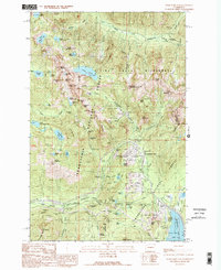
Editions of this 1989 Snoqualmie Pass Map
2 editions found
Other maps of this area

1901 · Snoqualmie Pass
USGS Topo · 1:125,000

1902 · Skykomish
USGS Topo · 1:125,000

1903 · Snoqualmie
USGS Topo · 1:125,000

1905 · Skykomish
USGS Topo · 1:125,000

1913 · Cedar Lake
USGS Topo · 1:125,000

1921 · Sultan
USGS Topo · 1:125,000

1923 · Sultan
USGS Topo · 1:125,000

1957 · Wenatchee
USGS Topo · 1:250,000

1960 · Mount Si
USGS Topo · 1:62,500

1960 · Bandera
USGS Topo · 1:62,500