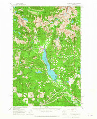
1961 Map of Snoqualmie Pass
USGS Topo · Published 1965About this map
Snoqualmie Pass serves as the central hub of this mid-century topographic study, capturing the intersection of alpine recreation and vital transit corridors. The landscape is defined by the massive footprint of Keechelus Lake and the dual presence of the Chicago Milwaukee St Paul and Pacific and Northern Pacific railroads. These rail lines, alongside the burgeoning development at the pass featuring ski lifts and a Ranger Station, illustrate the transition from a purely industrial mountain crossing to a recreational destination.
Find a feature on this map
157 named features on this map. Tap any name to fly to it.
Don’t see what you’re looking for? This feature index may not catch every label — zoom into the map to look around manually.
Map Details
Editions of this 1961 Snoqualmie Pass Map
3 editions found

Other maps of this area

1901 · Snoqualmie Pass
USGS Topo · 1:125,000

1902 · Skykomish
USGS Topo · 1:125,000

1903 · Snoqualmie
USGS Topo · 1:125,000

1905 · Skykomish
USGS Topo · 1:125,000

1913 · Cedar Lake
USGS Topo · 1:125,000

1921 · Sultan
USGS Topo · 1:125,000

1923 · Sultan
USGS Topo · 1:125,000

1956 · Greenwater
USGS Topo · 1:62,500

1957 · Wenatchee
USGS Topo · 1:250,000

1960 · Mount Si
USGS Topo · 1:62,500