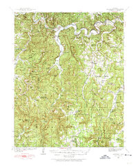
1939 Map of Snowball
USGS Topo · Published 1974About this map
Buffalo River meanders across the northern reaches of this Ozark landscape, defining a region of steep ridges and narrow hollows at the end of the 1930s. The settlement at Snowball serves as a local hub near Calf Creek, while more remote communities like Witts Springs and Imo anchor the southern uplands of Mount Pleasant. This survey illustrates a highly dispersed rural social structure, evidenced by a dense network of one-room schoolhouses such as Buroak Sch, Slicker Sch, and Happy Hollow Sch that once served these isolated valleys.
Find a feature on this map
82 named features on this map. Tap any name to fly to it.
Don’t see what you’re looking for? This feature index may not catch every label — zoom into the map to look around manually.
Map Details
Editions of this 1939 Snowball Map
2 editions found

Other maps of this area

1879 · Washington
USGS Topo · 1:62,500

1887 · Smyrna
USGS Topo · 1:62,500

1889 · Treat
USGS Topo · 1:62,500

1889 · Marshall #3
USGS Topo · 1:62,500

1892 · Marshall
USGS Topo · 1:125,000

1893 · Yellville
USGS Topo · 1:125,000

1894 · Marshall
USGS Topo · 1:125,000

1901 · Marshall
USGS Topo · 1:125,000

1903 · Yellville
USGS Topo · 1:125,000

1904 · Harrison
USGS Topo · 1:125,000