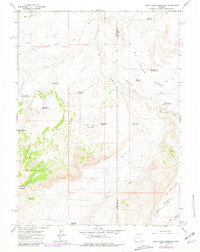
1964 Map of Soap Holes Reservoir
USGS Topo · Published 1981About this map
Cedar Mountain and the high desert expanse of Big Hollow dominate this landscape along the border of Uinta and Sweetwater Counties during the mid-1960s. The region is characterized by an extensive network of water management features, including many numbered reservoirs such as Seismograph Reservoir No 2 and High Mesa Reservoir No 2. These scattered catchments, along with named sites like Hordeum Reservoir and Soap Holes Reservoir, point to the critical role of water storage in supporting ranching or resource extraction in this arid terrain. Industrial activity is evident at the Standard Pit and East Fork Pit No 3, which sit amidst the high plateaus and drainage systems of Dry Creek and Big Hollow Creek. The presence of numerous jeep trails and the Cedar Rim Mountain road system illustrates how these high-elevation benches were navigated before more modern infrastructure arrived.
Find a feature on this map
25 named features on this map. Tap any name to fly to it.
Don’t see what you’re looking for? This feature index may not catch every label — zoom into the map to look around manually.
Map Details
Editions of this 1964 Soap Holes Reservoir Map
2 editions found
Other maps of this area

1954 · Ogden
USGS Topo · 1:250,000

1954 · Rock Springs
USGS Topo · 1:250,000

1958 · Ogden
USGS Topo · 1:250,000

1958 · Rock Springs
USGS Topo · 1:250,000

1960 · Ogden
USGS Topo · 1:250,000

1962 · Rock Springs
USGS Topo · 1:250,000

1964 · Butcher Knife Draw
USGS Topo · 1:24,000
1964 · Mc Kinnon
USGS Topo · 1:24,000

1964 · Soap Holes Reservoir
USGS Topo · 1:24,000

1964 · Reed Reservoir
USGS Topo · 1:24,000