
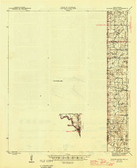
1945 Map of Socagee Bayou
USGS Topo · Published 1945About this map
Logansport anchors the southern edge of this mid-1940s survey, where the Southern Pacific railroad and Highway 84 cross the Sabine River at the Texas and Louisiana border. The landscape is a network of rural communities defined by their spiritual and educational centers, including Shiloh Ch, Bethel Ch, and Darrett Mission Ch, alongside local institutions like White Sch and Small Sch. A significant portion of the western territory is designated as an Unsurveyed Area, contrasting with the detailed mapping of the bayou country to the east. Waterways like Socagee Bayou, Little Creek, and Garrison Creek drain the timbered terrain of Panola Co and De Soto Parish. Genealogists will find particular value in the placement of the Hogeye Cem and Old Home Cem, which serve as physical anchors for family histories in this borderland region.
Find a feature on this map
25 named features on this map. Tap any name to fly to it.
Don’t see what you’re looking for? This feature index may not catch every label — zoom into the map to look around manually.
Map Details
Editions of this 1945 Socagee Bayou Map
2 editions found
Other maps of this area

1943 · Waskom
USGS Topo · 1:62,500

1944 · Logansport
USGS Topo · 1:62,500

1945 · Grand Cane
USGS Topo · 1:62,500

1945 · Waskom
USGS Topo · 1:62,500

1945 · Greenwood
USGS Topo · 1:62,500

1953 · Alexandria
USGS Topo · 1:250,000

1953 · Palestine
USGS Topo · 1:250,000

1955 · Shreveport
USGS Topo · 1:250,000

1955 · Alexandria
USGS Topo · 1:250,000

1955 · Greenwood
USGS Topo · 1:62,500