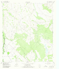
1961 Map of Soda Lake
USGS Topo · Published 1980About this map
The Pecos River serves as the dominant hydrological feature of this West Texas landscape, forming the boundary between Reeves Co and Ward Co. This 1961 field-checked survey reveals an arid territory defined by a complex irrigation network and burgeoning petroleum extraction. The Barstow Canal and Cedarvale Canal run parallel to the river, indicating the intensive water management required for agriculture in the Pecos Valley.
Find a feature on this map
12 named features on this map. Tap any name to fly to it.
Don’t see what you’re looking for? This feature index may not catch every label — zoom into the map to look around manually.
Map Details
Editions of this 1961 Soda Lake Map
3 editions found
Other maps of this area

1921 · Toyah
USGS Topo · 1:125,000

1931 · Barstow
USGS Topo · 1:125,000

1954 · Pecos
USGS Topo · 1:250,000

1957 · Pecos
USGS Topo · 1:250,000

1961 · Soda Lake
USGS Topo · 1:24,000

1961 · Mentone
USGS Topo · 1:24,000

1961 · Sand Lake
USGS Topo · 1:24,000

1963 · Quito Draw
USGS Topo · 1:24,000

1963 · Pecos East
USGS Topo · 1:24,000

1967 · Soda Lake NW
USGS Topo · 1:24,000