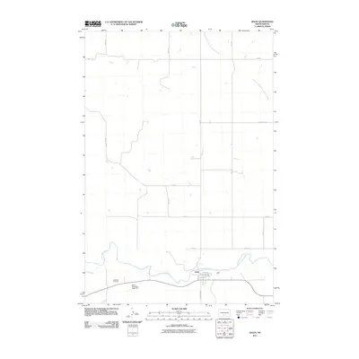
2011 Map of Solen
USGS Topo · Published 2011About this map
The town of Solen sits on the northern bank of a winding oxbow in the Cannonball River, serving as a central hub for this portion of Sioux County. The street grid of the settlement is clearly defined by routes like W Broadway St and Railroad Ave, reflecting its orientation toward local transport and the river. To the west, the Red Cedar Cemetery provides a focal point for genealogical interest, while the nearby Solen Township Road Dam indicates the infrastructure managing the region's prairie hydrology.
Find a feature on this map
21 named features on this map. Tap any name to fly to it.
Don’t see what you’re looking for? This feature index may not catch every label — zoom into the map to look around manually.
Map Details
Editions of this 2011 Solen Map
This is the sole edition of this map. No revisions or reprints were ever made.
Other maps of this area

1907 · Bismarck
USGS Topo · 1:125,000

1954 · Bismarck
USGS Topo · 1:250,000

1958 · Bismarck
USGS Topo · 1:250,000

1968 · Cannon Ball NW
USGS Topo · 1:24,000

1968 · Cannon Ball SW
USGS Topo · 1:24,000

1971 · Half Timber Butte
USGS Topo · 1:24,000

1971 · Huff
USGS Topo · 1:24,000

1971 · Solen SW
USGS Topo · 1:24,000

1979 · Bismarck
USGS Topo · 1:100,000

1980 · Solen
USGS Topo · 1:24,000