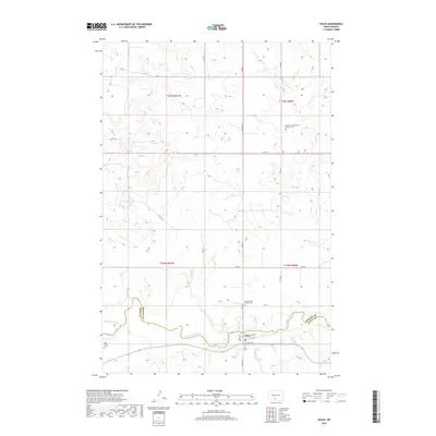
2018 Map of Solen
USGS Topo · Published 2018About this map
The Solen townsite sits at the confluence of local history and the meandering Cannonball River, serving as a central point in this prairie landscape. This 2018 survey detail shows a community organized around River St, Zahn Ave, and Main St, adjacent to the winding river corridor. The map is a valuable resource for genealogical research, documenting several local burial grounds including the Saint John the Baptist Catholic Cem and Sacred Heart Catholic Cem. To the west, the Red Cedar Cem marks a more isolated site near the river. The terrain is defined by the drainage patterns of the Northwest Br Cantapeta Cr and the larger Cannonball system, which forms the boundary between Morton and Sioux counties as it flows eastward.
Find a feature on this map
26 named features on this map. Tap any name to fly to it.
Don’t see what you’re looking for? This feature index may not catch every label — zoom into the map to look around manually.
Map Details
Editions of this 2018 Solen Map
This is the sole edition of this map. No revisions or reprints were ever made.
Other maps of this area

1907 · Bismarck
USGS Topo · 1:125,000

1954 · Bismarck
USGS Topo · 1:250,000

1958 · Bismarck
USGS Topo · 1:250,000

1968 · Cannon Ball NW
USGS Topo · 1:24,000

1968 · Cannon Ball SW
USGS Topo · 1:24,000

1971 · Half Timber Butte
USGS Topo · 1:24,000

1971 · Huff
USGS Topo · 1:24,000

1971 · Solen SW
USGS Topo · 1:24,000

1979 · Bismarck
USGS Topo · 1:100,000

1980 · Solen
USGS Topo · 1:24,000