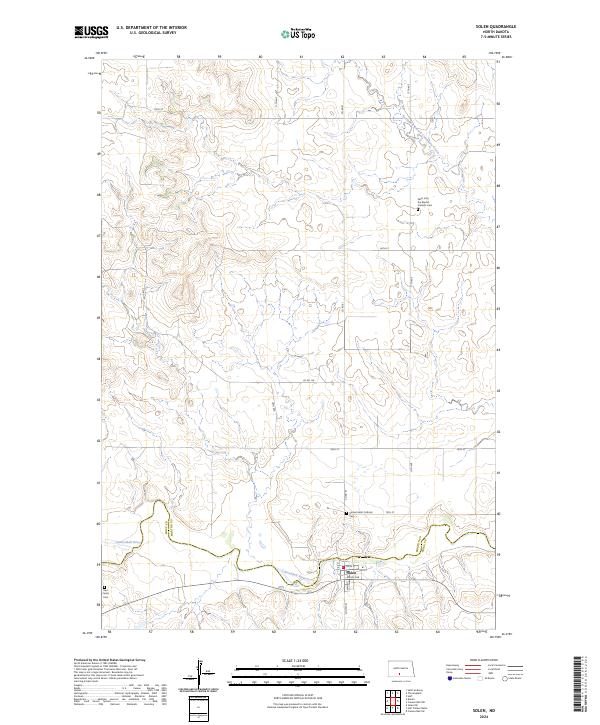
2024 Map of Solen
USGS Topo · Published 2024About this map
The Cannonball River defines the southern portion of this landscape as it meanders through the boundary between Morton and Sioux counties. Centered near the riverbank, the small community of Solen serves as the local hub, with its street grid including Main St, Zahn Ave, and River St. The surrounding high plains are largely defined by section lines and remote rural roads like Co Rd 81 and 17th Ave. Genealogists will find significant value in the distribution of regional burial sites, from the Saint John the Baptist Catholic Cem in the northeast to the Sacred Heart Catholic Cem and the Red Cedar Cem further south. The drainage of the Northwest Branch Cantapeta Creek marks the northern reaches of this territory, illustrating the hydrological patterns of the North Dakota prairie.
Find a feature on this map
28 named features on this map. Tap any name to fly to it.
Don’t see what you’re looking for? This feature index may not catch every label — zoom into the map to look around manually.
Map Details
Editions of this 2024 Solen Map
This is the sole edition of this map. No revisions or reprints were ever made.
Other maps of this area

1907 · Bismarck
USGS Topo · 1:125,000

1954 · Bismarck
USGS Topo · 1:250,000

1958 · Bismarck
USGS Topo · 1:250,000

1968 · Cannon Ball NW
USGS Topo · 1:24,000

1968 · Cannon Ball SW
USGS Topo · 1:24,000

1971 · Half Timber Butte
USGS Topo · 1:24,000

1971 · Huff
USGS Topo · 1:24,000

1971 · Solen SW
USGS Topo · 1:24,000

1979 · Bismarck
USGS Topo · 1:100,000

1980 · Solen
USGS Topo · 1:24,000