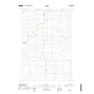
2018 Map of Solen SW
USGS Topo · Published 2018About this map
The Cannonball River meanders across this landscape on the border of Morton and Sioux counties, defining the northern geography of the Cannonball District. In this rural expanse, local history is anchored by Fair View Cem in the northwest and Saint Gabriel Cem near the northern boundary, providing critical reference points for genealogical research in this sparsely settled region. The terrain is marked by significant drainage patterns from Dogtooth Cr in the north to Porcupine Cr in the south, illustrating the natural watercourses that shaped early land divisions. This 2018 survey documents the section lines and township boundaries, including t133n r82w and t132n r82w, which continue to organize the agricultural and ranching tracts of the Standing Rock area.
Find a feature on this map
11 named features on this map. Tap any name to fly to it.
Don’t see what you’re looking for? This feature index may not catch every label — zoom into the map to look around manually.
Map Details
Editions of this 2018 Solen SW Map
This is the sole edition of this map. No revisions or reprints were ever made.
Other maps of this area

1954 · Bismarck
USGS Topo · 1:250,000

1958 · Bismarck
USGS Topo · 1:250,000

1971 · Barren Butte
USGS Topo · 1:24,000

1971 · Half Timber Butte
USGS Topo · 1:24,000

1971 · Froelich Dam
USGS Topo · 1:24,000

1971 · Solen SW
USGS Topo · 1:24,000

1971 · Porcupine
USGS Topo · 1:24,000

1971 · Timmer
USGS Topo · 1:24,000

1980 · Solen
USGS Topo · 1:24,000

1980 · Breien
USGS Topo · 1:24,000
Featured Places
- Cannonball District, ND
- Fort Yates District, ND
- Porcupine District, ND
- Morton County, ND
- Sioux County, ND