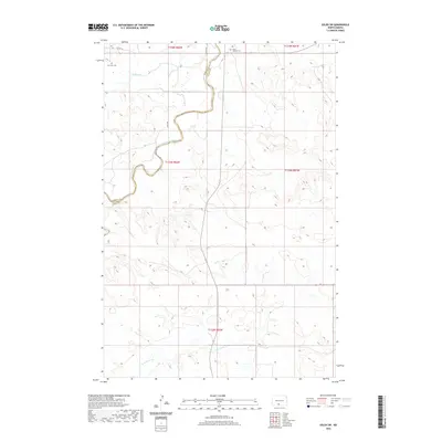
2020 Map of Solen SW
USGS Topo · Published 2020About this map
The Cannonball River meanders across this rural landscape in the Sioux County region, carving a deep, winding path through the prairie. This topography is defined by its drainage basins, with Dogtooth Cr to the north and Porcupine Cr to the south framing the central river valley. The map reveals the quiet persistence of early settlement patterns, where small burial grounds like Saint Gabriel Cem and Fair View Cem serve as the primary landmarks in an area otherwise dominated by open range and section lines. The intersection of Morton and Sioux counties is marked here, showing how political boundaries align with the natural and surveyed landscape. Modern rural access is maintained through a grid of section roads including Co Rd 134, 25th Ave, and 26th Ave, providing a clear view of the sparse but orderly development of this Great Plains territory.
Find a feature on this map
14 named features on this map. Tap any name to fly to it.
Don’t see what you’re looking for? This feature index may not catch every label — zoom into the map to look around manually.
Map Details
Editions of this 2020 Solen SW Map
This is the sole edition of this map. No revisions or reprints were ever made.
Other maps of this area

1954 · Bismarck
USGS Topo · 1:250,000

1958 · Bismarck
USGS Topo · 1:250,000

1971 · Barren Butte
USGS Topo · 1:24,000

1971 · Half Timber Butte
USGS Topo · 1:24,000

1971 · Froelich Dam
USGS Topo · 1:24,000

1971 · Solen SW
USGS Topo · 1:24,000

1971 · Porcupine
USGS Topo · 1:24,000

1971 · Timmer
USGS Topo · 1:24,000

1980 · Solen
USGS Topo · 1:24,000

1980 · Breien
USGS Topo · 1:24,000
Featured Places
- Cannonball District, ND
- Fort Yates District, ND
- Porcupine District, ND
- Morton County, ND
- Sioux County, ND