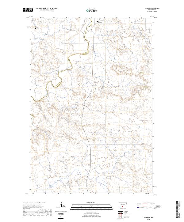
2024 Map of Solen SW
USGS Topo · Published 2024About this map
The Cannonball River winds through the northern portion of this landscape, forming a natural boundary along the Morton Co Sioux Co line. This rural stretch of the Great Plains is defined by its deep drainages and intermittent watercourses, including Dogtooth Creek and Porcupine Creek to the south. The area maintains a quiet, agricultural character, with long-established section lines and roads like 25th Ave and 26th Ave providing the primary transit network through the hills. For genealogists and local historians, the map documents the locations of Fair View Cem and Saint Gabriel Cem, which serve as permanent anchors for the families who have inhabited this region of North Dakota across several generations.
Find a feature on this map
14 named features on this map. Tap any name to fly to it.
Don’t see what you’re looking for? This feature index may not catch every label — zoom into the map to look around manually.
Map Details
Editions of this 2024 Solen SW Map
This is the sole edition of this map. No revisions or reprints were ever made.
Other maps of this area

1954 · Bismarck
USGS Topo · 1:250,000

1958 · Bismarck
USGS Topo · 1:250,000

1971 · Barren Butte
USGS Topo · 1:24,000

1971 · Half Timber Butte
USGS Topo · 1:24,000

1971 · Froelich Dam
USGS Topo · 1:24,000

1971 · Solen SW
USGS Topo · 1:24,000

1971 · Porcupine
USGS Topo · 1:24,000

1971 · Timmer
USGS Topo · 1:24,000

1980 · Solen
USGS Topo · 1:24,000

1980 · Breien
USGS Topo · 1:24,000
Featured Places
- Cannonball District, ND
- Fort Yates District, ND
- Porcupine District, ND
- Morton County, ND
- Sioux County, ND