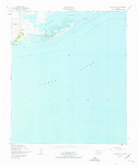
1950 Map of Solomon B-6
USGS Topo · Published 1975About this map
Safety Sound and its complex network of mud flats and tidal inlets dominate this 1950 coastal survey of the Seward Peninsula. The landscape is defined by the thin barrier spit that separates the sound from the open waters of Norton Sound, creating a protected maritime corridor. At the narrow entrance to this waterway lies Port Safety, where the Port Safety Roadhouse provided a critical stop for travelers along the coast. To the west, the terrain rises abruptly from the shore at Cape Nome and reaches inland toward Reindeer Hill. This area, mapped primarily from aerial photography, illustrates the remote coastal geography southeast of Nome during the mid-twentieth century, featuring triangulation stations like Vabm 503 used for precise coastal navigation and mapping.
Find a feature on this map
8 named features on this map. Tap any name to fly to it.
Don’t see what you’re looking for? This feature index may not catch every label — zoom into the map to look around manually.
Map Details
Editions of this 1950 Solomon B-6 Map
3 editions found
Other maps of this area

1907 · Solomon
USGS Topo · 1:62,500

1950 · Nome
USGS Topo · 1:250,000

1950 · Solomon C-5
USGS Topo · 1:63,360

1950 · Solomon C-6
USGS Topo · 1:63,360

1950 · Nome B-1
USGS Topo · 1:63,360

1950 · Solomon B-6
USGS Topo · 1:63,360

1950 · Solomon
USGS Topo · 1:250,000

1950 · Nome C-1
USGS Topo · 1:63,360

1951 · Nome
USGS Topo · 1:250,000

1951 · Solomon
USGS Topo · 1:250,000