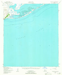
1950 Map of Solomon B-6
USGS Topo · Published 1965About this map
Cape Nome anchors this coastal landscape where the waters of Norton Sound meet the protected expanse of Safety Sound. The area reflects the maritime and travel infrastructure of the mid-century Seward Peninsula, centered on the narrow spit that separates the lagoon from the open sea. A ferry crossing connects the coastline near the Port Safety Roadhouse, a critical stop for travelers moving between Nome and points east. This topographic record, based on 1950 aerial photography, captures the natural mudflats and navigation aids, including a light guarding the entrance to Port Safety. The prominence of Reindeer Hill provides a rare point of elevation along an otherwise low-lying, tide-influenced shoreline defined by shifting sands and maritime transit.
Find a feature on this map
9 named features on this map. Tap any name to fly to it.
Don’t see what you’re looking for? This feature index may not catch every label — zoom into the map to look around manually.
Map Details
Editions of this 1950 Solomon B-6 Map
3 editions found
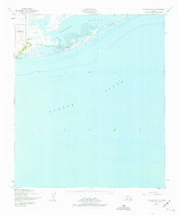
Other maps of this area

1907 · Solomon
USGS Topo · 1:62,500

1950 · Nome
USGS Topo · 1:250,000

1950 · Solomon C-5
USGS Topo · 1:63,360

1950 · Solomon C-6
USGS Topo · 1:63,360

1950 · Nome B-1
USGS Topo · 1:63,360

1950 · Solomon B-6
USGS Topo · 1:63,360

1950 · Solomon
USGS Topo · 1:250,000

1950 · Nome C-1
USGS Topo · 1:63,360

1951 · Nome
USGS Topo · 1:250,000

1951 · Solomon
USGS Topo · 1:250,000