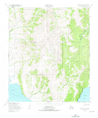
1950 Map of Solomon C-2
USGS Topo · Published 1975About this map
The Native Reservation dominates the eastern coastal landscape of the Seward Peninsula in this mid-century survey, where the Kwiniuk River winds through interior highlands toward Norton Bay. This is a territory defined by seasonal transit and survival, marked by a pervasive Winter Trail and a Telephone Line that provided essential communication links between remote outposts. Sparse human infrastructure is represented by a lone Cabin and a Shelter, reflecting the area's isolation and the necessity of refuge during harsh subarctic winters. Along the western edge, the coastline at Golovnin Bay is framed by the Limestone Cliffs, while numerous drainages like McKinley Creek and Eagle Creek carve through the high elevations, illustrating a drainage system that supported indigenous travel and subsistence long before modern mapping.
Find a feature on this map
17 named features on this map. Tap any name to fly to it.
Don’t see what you’re looking for? This feature index may not catch every label — zoom into the map to look around manually.
Map Details
Editions of this 1950 Solomon C-2 Map
2 editions found
Other maps of this area

1950 · Solomon B-3
USGS Topo · 1:63,360

1950 · Solomon B-2
USGS Topo · 1:63,360

1950 · Solomon D-2
USGS Topo · 1:63,360

1950 · Solomon C-2
USGS Topo · 1:63,360

1950 · Solomon C-1
USGS Topo · 1:63,360

1950 · Solomon D-1
USGS Topo · 1:63,360

1950 · Solomon D-3
USGS Topo · 1:63,360

1950 · Solomon
USGS Topo · 1:250,000

1950 · Solomon C-3
USGS Topo · 1:63,360

1951 · Solomon
USGS Topo · 1:250,000