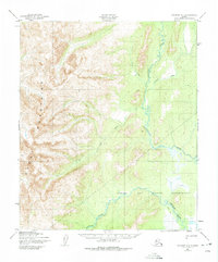
1950 Map of Solomon D-1
USGS Topo · Published 1975About this map
The Darby Mountains dominate this 1950s landscape, their steep contours descending sharply toward the coastal lowlands. This survey illustrates the isolation of the Seward Peninsula just before mid-century, where the primary movement through the terrain relied on a mapped Winter Trail crossing the Kwiniuk River. To the east, the Norton Bay Native Reservation covers a significant portion of the river delta and coastal flats, highlighting the intersection of federal land management and indigenous territory during this era. The drainage patterns are clearly defined by the winding paths of the Tubutulik River and its tributaries, including Vulcan Creek and Chukajak Creek, which cut through the mountains to reach Norton Bay. These waterways and the established winter route represent the essential corridors for travel and subsistence in an environment with no developed road infrastructure.
Find a feature on this map
8 named features on this map. Tap any name to fly to it.
Don’t see what you’re looking for? This feature index may not catch every label — zoom into the map to look around manually.
Map Details
Editions of this 1950 Solomon D-1 Map
2 editions found
Other maps of this area

1948 · Norton Bay
USGS Topo · 1:250,000

1950 · Bendeleben A-2
USGS Topo · 1:63,360

1950 · Bendeleben A-1
USGS Topo · 1:63,360

1950 · Norton Bay D-6
USGS Topo · 1:63,360

1950 · Solomon D-2
USGS Topo · 1:63,360

1950 · Solomon C-2
USGS Topo · 1:63,360

1950 · Bendeleben
USGS Topo · 1:250,000

1950 · Solomon C-1
USGS Topo · 1:63,360

1950 · Norton Bay C-6
USGS Topo · 1:63,360

1950 · Solomon D-1
USGS Topo · 1:63,360