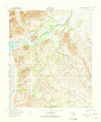
1950 Map of Solomon D-6
USGS Topo · Published 1975About this map
The Kigluaik Mountains dominate the northern terrain of this 1950s study, where the Pilgrim River carves a path through a landscape shaped by early mining and transport. Traces of the region's industrial past are visible in the Seward Peninsula Railroad (Abandoned), which once served the interior gold fields. Small outposts such as Iron Creek and Bubs represent the scattered activity of this era, connected by a network of Tractor Trails and pack routes.
Find a feature on this map
49 named features on this map. Tap any name to fly to it.
Don’t see what you’re looking for? This feature index may not catch every label — zoom into the map to look around manually.
Map Details
Editions of this 1950 Solomon D-6 Map
3 editions found

Other maps of this area

1907 · Casadepaga
USGS Topo · 1:62,500

1907 · Solomon
USGS Topo · 1:62,500

1950 · Bendeleben A-6
USGS Topo · 1:63,360

1950 · Bendeleben A-5
USGS Topo · 1:63,360

1950 · Nome
USGS Topo · 1:250,000

1950 · Solomon C-5
USGS Topo · 1:63,360

1950 · Solomon C-6
USGS Topo · 1:63,360

1950 · Teller
USGS Topo · 1:250,000

1950 · Bendeleben
USGS Topo · 1:250,000

1950 · Solomon
USGS Topo · 1:250,000