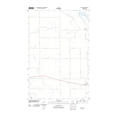
2010 Map of Solway
USGS Topo · Published 2010About this map
The Little Mississippi River winds through this Beltrami County landscape, its headwaters forming a distinct drainage pattern south of the meandering Clearwater River. This 2010 survey shows the rural character of the area surrounding Solway, where the Solway Post Office serves as a central landmark for the local community. Further north, the settlement of Pinewood is situated near the northern reach of the Clearwater, while the waters of Buzzle Lake occupy the northeastern corner of the map.
Find a feature on this map
33 named features on this map. Tap any name to fly to it.
Don’t see what you’re looking for? This feature index may not catch every label — zoom into the map to look around manually.
Map Details
Editions of this 2010 Solway Map
This is the sole edition of this map. No revisions or reprints were ever made.
Other maps of this area

1919 · Solway
USGS Topo · 1:62,500

1943 · Solway
USGS Topo · 1:62,500

1943 · Bagley
USGS Topo · 1:62,500

1954 · Bemidji
USGS Topo · 1:250,000

1957 · Bemidji
USGS Topo · 1:250,000

1958 · Bemidji
USGS Topo · 1:250,000

1969 · Leonard
USGS Topo · 1:24,000

1969 · Shevlin
USGS Topo · 1:24,000
1969 · Upper Rice Lake
USGS Topo · 1:24,000

1972 · Alida
USGS Topo · 1:24,000