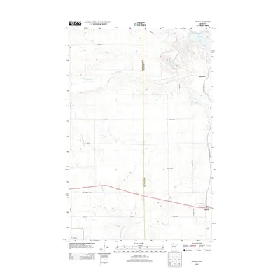
2013 Map of Solway
USGS Topo · Published 2013About this map
Solway and the surrounding rural landscapes of Clearwater and Beltrami counties appear here as they were structured in the early 21st century. The terrain is defined by the headwaters of two significant waterways: the Clearwater River and the Little Mississippi River, which meander through a patchwork of agricultural lands and wooded sections. The map preserves the specific locations of local landmarks such as Blackstar Dairy and the small northern settlement of Pinewood. Transportation routes are anchored by Us-2, which runs parallel to the older alignment of the Old Jefferson Hwy. For those researching family history in this corner of Minnesota, the sheet provides precise locations for both the Solway Cem and the Shevlin Moose Cem, offering a detailed view of the community's established physical boundaries and memorial sites.
Find a feature on this map
26 named features on this map. Tap any name to fly to it.
Don’t see what you’re looking for? This feature index may not catch every label — zoom into the map to look around manually.
Map Details
Editions of this 2013 Solway Map
This is the sole edition of this map. No revisions or reprints were ever made.
Other maps of this area

1919 · Solway
USGS Topo · 1:62,500

1943 · Solway
USGS Topo · 1:62,500

1943 · Bagley
USGS Topo · 1:62,500

1954 · Bemidji
USGS Topo · 1:250,000

1957 · Bemidji
USGS Topo · 1:250,000

1958 · Bemidji
USGS Topo · 1:250,000

1969 · Leonard
USGS Topo · 1:24,000

1969 · Shevlin
USGS Topo · 1:24,000
1969 · Upper Rice Lake
USGS Topo · 1:24,000

1972 · Alida
USGS Topo · 1:24,000