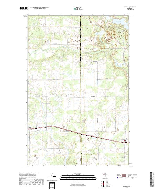
2022 Map of Solway
USGS Topo · Published 2022About this map
Solway and Shevlin anchor the southern corridor of this modern survey, marking a landscape defined by the drainage divide between the north-flowing Clearwater River and the headwaters of the Little Mississippi River. The terrain is scattered with numerous small wetlands and basins, including Buzzle Lake in the northeast corner near the settlement of Pinewood. For local history and genealogy research, the map identifies specific community landmarks such as Solway Cem and the Shevlin - Moose Cem. Transport patterns are represented by the established route of Old Jefferson Hwy and the extensive Wilton Trails Northwest Trl system that weaves through the northern sections. The boundary between Clearwater and Beltrami counties bisects the map vertically, illustrating the jurisdictional split of this rural northern Minnesota region.
Find a feature on this map
36 named features on this map. Tap any name to fly to it.
Don’t see what you’re looking for? This feature index may not catch every label — zoom into the map to look around manually.
Map Details
Editions of this 2022 Solway Map
This is the sole edition of this map. No revisions or reprints were ever made.
Other maps of this area

1919 · Solway
USGS Topo · 1:62,500

1943 · Solway
USGS Topo · 1:62,500

1943 · Bagley
USGS Topo · 1:62,500

1954 · Bemidji
USGS Topo · 1:250,000

1957 · Bemidji
USGS Topo · 1:250,000

1958 · Bemidji
USGS Topo · 1:250,000

1969 · Leonard
USGS Topo · 1:24,000

1969 · Shevlin
USGS Topo · 1:24,000
1969 · Upper Rice Lake
USGS Topo · 1:24,000

1972 · Alida
USGS Topo · 1:24,000