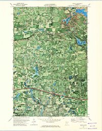
1972 Map of Solway
USGS Topo · Published 1974About this map
The Old Indian Treaty Boundary cuts across this northern Minnesota landscape, marking a historical line through Beltrami and Clearwater counties. In this 1970s orthophotomap, the aerial perspective reveals the dense forest cover and wetland pockets characteristic of the region, punctuated by the Clearwater River as it winds eastward. The small community of Solway sits at a transportation nexus where the Burlington Northern railroad runs parallel to the primary highway, while the Solway Cem provides a focal point for genealogical research. To the north, Pinewood is surrounded by timber and small clearings, reflecting the area's rural character.
Find a feature on this map
18 named features on this map. Tap any name to fly to it.
Don’t see what you’re looking for? This feature index may not catch every label — zoom into the map to look around manually.
Map Details
Editions of this 1972 Solway Map
This is the sole edition of this map. No revisions or reprints were ever made.
Other maps of this area

1919 · Solway
USGS Topo · 1:62,500

1943 · Solway
USGS Topo · 1:62,500

1943 · Bagley
USGS Topo · 1:62,500

1954 · Bemidji
USGS Topo · 1:250,000

1957 · Bemidji
USGS Topo · 1:250,000

1958 · Bemidji
USGS Topo · 1:250,000

1969 · Leonard
USGS Topo · 1:24,000

1969 · Shevlin
USGS Topo · 1:24,000
1969 · Upper Rice Lake
USGS Topo · 1:24,000

1972 · Alida
USGS Topo · 1:24,000