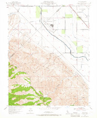
1953 Map of Solyo
USGS Topo · Published 1966About this map
The Naval Auxiliary Air Station occupies a prominent position on the flatlands of the San Joaquin Valley, illustrating the military's mid-century footprint in this agricultural region. The landscape transitions sharply from the irrigation infrastructure of the Hetch Hetchy Aqueduct and the Delta-Mendota Canal into the steep rises of the Diablo Range. High points like Mt Oso overlook a network of seasonal drainages including Hospital Creek and Ingram Creek. Near the Southern Pacific railroad line, the small settlement of Solyo and the Rising Sun School serve as focal points for the local farming community. Further into the hills, place names like Chicken Flat and various reservoirs suggest a history of ranching and water management. The boundary between San Joaquin and Stanislaus counties bisects the terrain, while the El Pescadero (Grimes) Grant line reflects older land tenure systems.
Find a feature on this map
36 named features on this map. Tap any name to fly to it.
Don’t see what you’re looking for? This feature index may not catch every label — zoom into the map to look around manually.
Map Details
Editions of this 1953 Solyo Map
4 editions found
Other maps of this area

1913 · Romain
USGS Topo · 1:31,680

1915 · Vernalis
USGS Topo · 1:31,680

1915 · Ripon
USGS Topo · 1:31,680

1915 · Westley
USGS Topo · 1:31,680

1916 · Patterson
USGS Topo · 1:31,680

1916 · Tracy
USGS Topo · 1:31,680

1916 · Romain
USGS Topo · 1:31,680

1919 · Orestimba
USGS Topo · 1:62,500

1922 · Carbona
USGS Topo · 1:62,500

1938 · Mt. Boardman
USGS Topo · 1:62,500