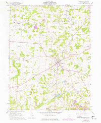
1961 Map of Somerset
USGS Topo · Published 1977About this map
The village of Somerset serves as the central hub of this Perry County landscape, where the Baltimore and Ohio railroad intersects with a grid of rural roads and historical landmarks. The area is defined by its deep religious and community roots, evidenced by the presence of St Pauls Ch, Hopewell Ch, and St Josephs Priory. Smaller settlements such as New Reading, Chalfants, and Ziontown reflect the early 1960s residential pattern of the region.
Find a feature on this map
33 named features on this map. Tap any name to fly to it.
Don’t see what you’re looking for? This feature index may not catch every label — zoom into the map to look around manually.
Map Details
Editions of this 1961 Somerset Map
3 editions found
Other maps of this area

1907 · Logan
USGS Topo · 1:62,500

1909 · Thornville
USGS Topo · 1:62,500

1909 · Logan
USGS Topo · 1:62,500

1910 · Zanesville
USGS Topo · 1:62,500

1911 · New Lexington
USGS Topo · 1:62,500

1947 · Columbus
USGS Topo · 1:250,000

1961 · Columbus
USGS Topo · 1:250,000

1961 · Rushville
USGS Topo · 1:24,000
1961 · Thornville
USGS Topo · 1:24,000

1961 · New Lexington
USGS Topo · 1:24,000